2008, 13 days
Guidebook:
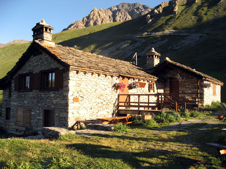 Refuge du Vallonbrun (July 2008)
Map: [show map help] [larger map]
| Date | Daytime | Overnight | Alternatives/Notes |
|---|---|---|---|
| Day 1 Sat 12 Jul |
06:00 T2 flight KLM1072 arr. Amsterdam 08:25. |
Hôtel de la Vanoise *** 04 79 08 70 34 One double and one twin half board, €70 pppn, 25% deposit paid |
|
| Day 2 Sun 13 Jul |
Walk 4-4½ hrs to Refuge de Péclet-Polset (2474m). | Refuge
de Péclet-Polset (CAF, 84 places) CAF = Club Alpin Français |
Short evening stroll to Lac Blanc. |
| Day 3 Mon 14 Jul |
Walk 3½ hrs via Col de Chavière (2796m) to Refuge de l'Orgère (1935m). | Refuge de l'Orgère (PNV,
56 places) PNV = Parc National de la Vanoise |
Other hut nearby: This walk replaces the last and first days (to/from Modane) in the guidebook. |
| Day 4 Tue 15 Jul |
Walk 4½ hrs via Col du Barbier (2287m) and Pont de la Séttéria (2206m) to Refuge du Plan Sec (2320m). | Refuge du Plan
Sec (private, 64 places) 04 79 20 31 31 |
Three other huts nearby: Refuge de la Fournache (2330m, private, 37 places) 06 09 38 72 38. Refuge de la Dent Parrachée (2511m, CAF, 40 places) 04 79 20 32 87. Refuge du Fond d'Aussois (2350m, CAF, 42 places) 04 79 20 39 83. |
| Day 5 Wed 16 Jul |
Walk 5½-6 hrs to Refuge de l'Arpont (2309m). | Refuge de l'Arpont (PNV, 92 places) 04 79 20 51 51 |
|
| Day 6 Thu 17 Jul |
Walk 5 hrs to Refuge-Porte du Plan du Lac (2364m). | Refuge-Porte du Plan du Lac (PNV, 42 places) 04 79 20 50 85 |
The lake is a ten-minute walk away. |
| Day 7 Fri 18 Jul |
Walk 6 hrs via Refuge de Cuchet (2160m, 4 hrs, lunch?) to Refuge du Vallonbrun (2270m). | Refuge du Vallonbrun (PNV, 27 places) 04 79 05 93 93 |
|
| Day 8 Sat 19 Jul |
Walk 4½ hrs via Bessans (1705m, 2¼ hrs, lunch) to Bonneval-sur-Arc (1787m). | Hotel À la Pastourelle
** 04 79 05 81 56 |
|
| Day 9 Sun 20 Jul |
Walk 5½-6 hrs via Col d'Iseran (2764m, 3½ hrs, lunch) to Val d'Isere (1809m). | Hotel in Val d'Isere. | |
| Day 10 Mon 21 Jul |
Walk 6-6½ hrs via Pas de la Toviére (2252m), Tignes (2093m), Val Claret (2102m, 2¾ hrs, lunch), and Col de la Leisse (2758m) to Refuge de la Leisse (2487m). | Refuge del la Leisse (PNV, 32 places) 04 79 05 45 33 |
Long day, could be shortened by taking a bus or taxi to Tignes. |
| Day 11 Tue 22 Jul |
Walk 6 hrs via Col de la Vanoise (2517m) with its Refuge (3½ hrs, lunch) to Pralognan (1418m). | Hôtel de la Vanoise *** (again) |
|
| Day 12 Wed 23 Jul |
Day walk or relax. | Hôtel de la Vanoise *** (again) |
|
| Day 13 Thu 24 Jul |
Taxi to Moûtiers. 08:41 train arr. Chambery Challes 09:50. 10:01 train arr. Lyon Part Dieu 11:16. Bus or taxi to airport (15 miles). 13:45 flight AF7643 arr. Paris CDG 14:55. 16:05 flight AF2568 arr. Manchester 16:35. |
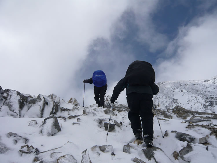 Rebecca and Peter approaching Col de Chavière (July 2008)
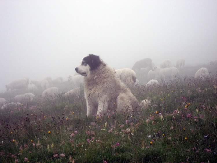 A dog guarding the sheep in the mist (July 2008)